
OMAHA, Neb. (WOWT) – There are a number of power outages for Omaha Public Power District and MidAmerican Energy customers on Thursday morning.
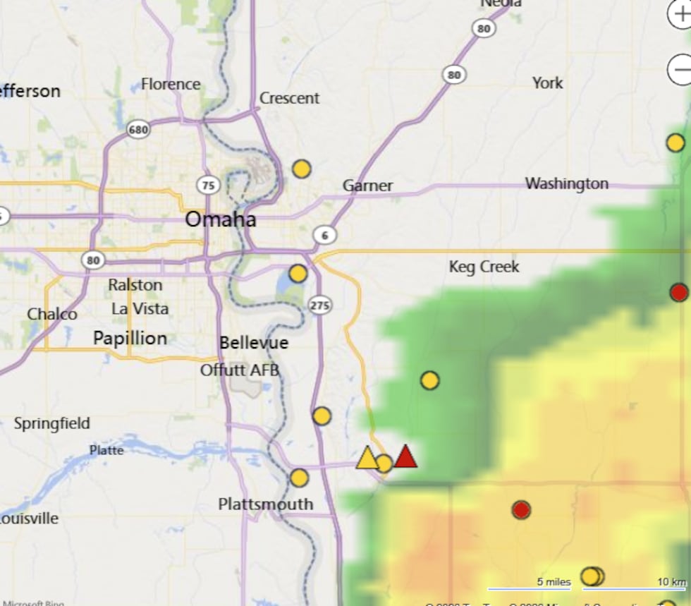
Outages started early Thursday as a complex of strong to severe thunderstorms rolled though Nebraska, hitting hardest in areas south of the Omaha metro and into southwest Iowa. Storms erupted in the area around 2:30 a.m., shortly after the National Weather Service issued a Severe Thunderstorm Watch.
At 7 a.m., a look of the OPPD outage map showed over 2,800 customers without power. Across portions of eastern Nebraska and western Iowa, more than 13,000 customers lost power during the storm.

MidAmerican Energy‘s map is showing over 5,000 customers having no power as of 7 a.m. — mainly in the Council Bluffs area.
Cass County Emergency Management Agency said there is power outages and major tree damage in Weeping Water. Downed branches were also seen in Plattsmouth, as well as some Iowa towns: Malvern, Villisca, and Glenwood.
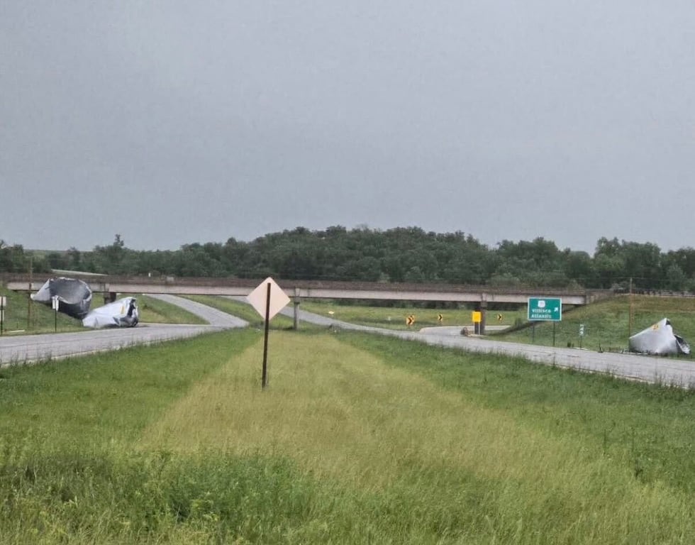
The Iowa Department of Transportation shared a photo of damaged grain bins blown near the interchange of US-34 and US-71, north of Villisca.
The National Weather Service issued tornado warnings Thursday morning for Montgomery, Mills, Fremont, Page, and Pottawattamie counties as storms rolled through the area.
First Alert 6's weather team is sharing reports of hail, wind, and tornadoes in the area.

Radar estimation for rainfall shows the heaviest totals to the south of the metro to the Missouri border. Six inches of rain fell in Sidney, Iowa and Shenandoah had reports of several inches of water over residential roadways and pooling in yards.

A possible tornado was recorded moving through Cass County, Nebraska on Thursday morning.
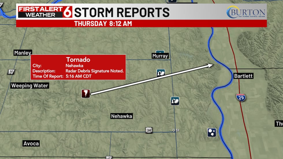
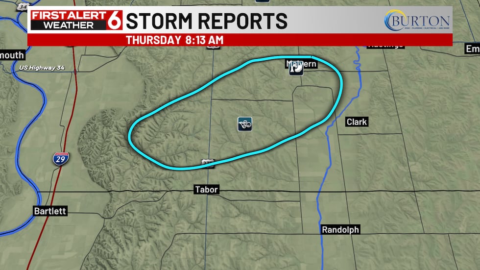
Another tornado was reported making its way through Mills County with a clear debris signature on the radar.
—
Watch breaking news unfold on our livestream. Download the First Alert 6 streaming app to your TV or find us in your favorite streaming platform.
Copyright 2026 WOWT. All rights reserved.


/2026/06/11/6a2a9d8bc94f2058438041.jpg "Coupe du monde 2026 : pour la FIFA, lidée cest jouer plus pour générer plus de recettes, selon un spécialiste du sport business")